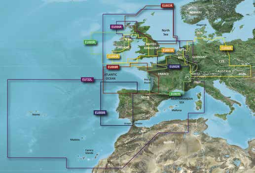
Garmin BlueChart g3 and g3 Vision charts - Europe regular
(Check plotter compatibility here)
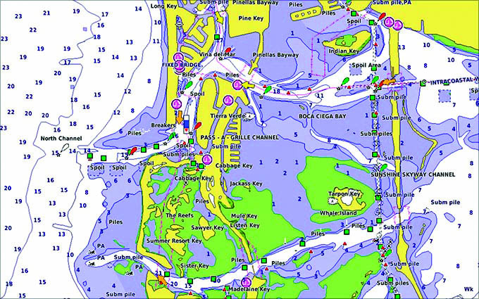
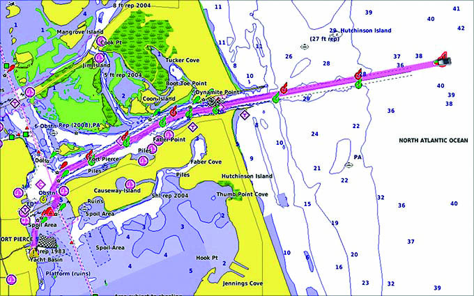
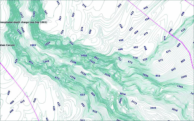
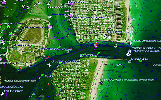
Garmin BlueChart g3 features up to 1ft contours that provide a more accurate depiction of bottom structure for improved fishing charts and enhanced detail in swamps, canals and port plans.
Charts are highly detailed with Navionics data to help mariners guide their boats in and out of port with confidence. |
|
|
|
|
|
|
|
Features: Depth range shading
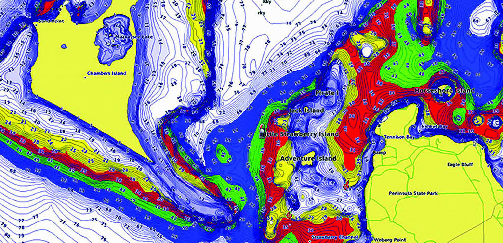
Shallow water shading
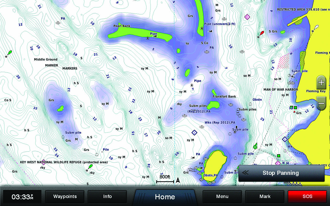
Overview - Chart detail
Overview - auto guidance
Overview - detailed contours
Overview - aerial photography - only with g3 vision
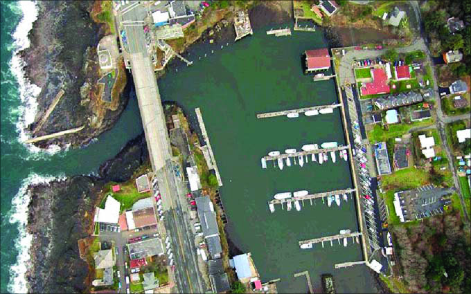
Overview - satellite imagery - only with g3 Vision
3D FishEye view - only with g3 Vision

3D MarinersEye view - only with g3 vision

Garmin BlueChart HXEU018RU g3 chart Updates - Benelux Offshore, Inland
£59.99
in stock
More info
Garmin BlueChart VEU018R g3 Vision chart - Benelux Ofshore, Inland
£215.00
in stock
More info
Garmin BlueChart VEU018RU g3 Vision chart Updates - Benelux Ofshore, Inland
£116.99
in stock
More info